Maps of Jewish Communities and their Populations in Europe: 1750 – 1950
Principal Researcher: Dr. Laurence Leitenberg
Technical Map Specialist: Sandy Crystall
These maps have been created for the International Institute for Jewish Genealogy by Sandra Crystall based on the research of Laurence Leitenberg (La population juive des villes d’Europe. Croissance et répartition, 1750 – 1930, Peter Lang, Bern 2008), augmented by Leitenberg’s further research to add post- Holocaust (circa 1950) population data.
The maps cover a central period of Jewish history in Europe. As a consequence of a migratory movement initiated in the Middle Ages and fostered by population growth from the eighteenth century to World War II, Europe was predominant in the geographic distribution of world Jewry.
At the dawn of the eighteenth century, it is estimated that 65.1% of world Jewry were living in Europe. This proportion increased further and reached more than 80% in the nineteenth century. After the nineteenth century the Jewish population continued to grow in absolute numbers. However, as a result of the overseas emigration stream, Europe’s share of world Jewry declined. Even so, on the eve of World War II, 57.2% of the Jewish population lived in Europe. After the Holocaust, this proportion fell to 32.2% in 1948.
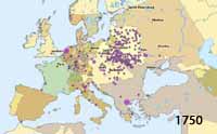
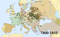
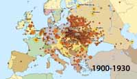
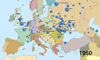
Four maps of Jewish populations in Europe are presented. With the four maps, population data for a total of 827 communities (ranging from 184 to 770 on a single map) are depicted in one or more time frames of 1750, 1800, 1850, 1900, 1930 and 1950.
Two maps (“1800 and 1850” and “1900 and 1930”) each display two sets of graduated circles representing the Jewish populations of localities in two time frames, and two maps (1750 and 1950) each use graduated circles to represent the populations in a single time frame.
Each map displays the country boundaries for the same or close time frame. For Map 1750, country boundaries are for 1700; for Map 1800 and 1850, country boundaries are for 1800; for Map 1900 and 1930, country boundaries are for 1900; for Map 1950, country boundaries represent those as of 1951.
Click here to view or download guide (pdf).
Click on a map to load the full map and data for each time frame.


The maps cover a central period of Jewish history in Europe. As a consequence of a migratory movement initiated in the Middle Ages and fostered by population growth from the eighteenth century to World War II, Europe was predominant in the geographic distribution of world Jewry.
At the dawn of the eighteenth century, it is estimated that 65.1% of world Jewry were living in Europe. This proportion increased further and reached more than 80% in the nineteenth century. After the nineteenth century the Jewish population continued to grow in absolute numbers. However, as a result of the overseas emigration stream, Europe’s share of world Jewry declined. Even so, on the eve of World War II, 57.2% of the Jewish population lived in Europe. After the Holocaust, this proportion fell to 32.2% in 1948.
Click here for the final report with more information about the research, selection of communities, trends discussed, and creation of the maps.
© International Institute for Jewish Genealogy, 2014